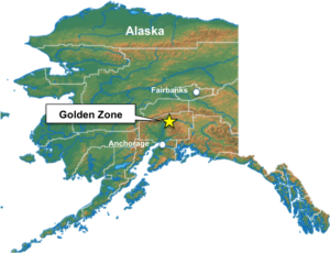
The Golden Zone Property is located entirely on State of Alaska owned lands and falls within Alaska’s Valdez Creek Mining District and the Talkeetna Recording District approximately 230 kilometres (km) north of Anchorage and 210 km south of Fairbanks.
The climate in the Project area is mountain continental but has a maritime influence in the summer because of its proximity to the coast and the warm Japanese current emanating from the Gulf of Alaska. The effective season for field exploration operations in the Project area runs from June through late September or early October. Mine operations in the region with supporting infrastructure, can operate year-round.
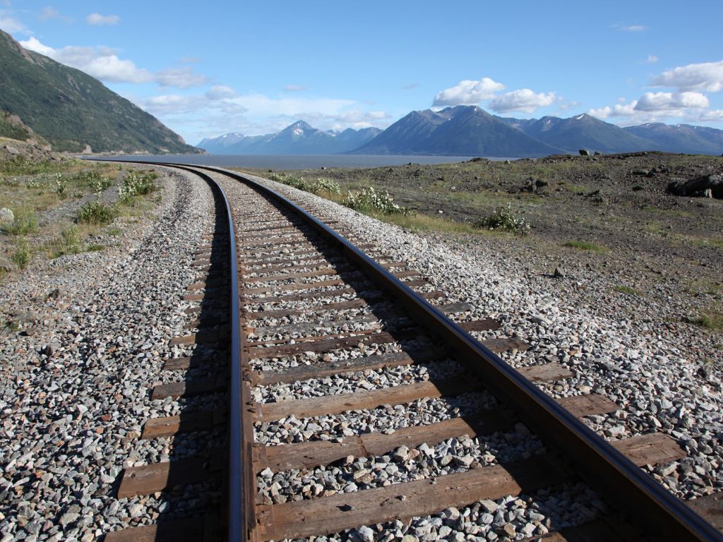
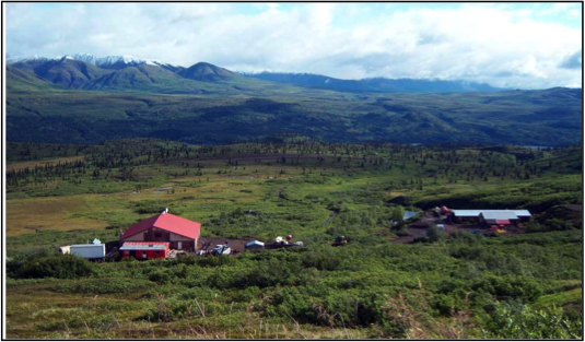
Infrastructure
The property is located about 10 kms from the main transportation corridor between Anchorage and Fairbanks which contains the George Parks Highway (Alaska Route 3), the Alaska Railroad and the 345Kv Alaska Intertie.
A 610 m gravel airstrip is located at Colorado Station and a 365 m airstrip is located within the upland lease on the access road approximately 1 km northeast of the Golden Zone camp.
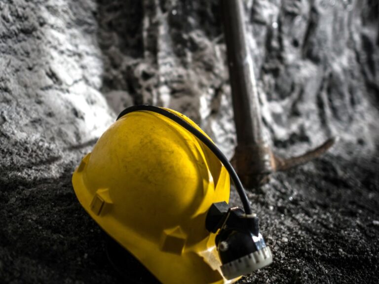
Project History
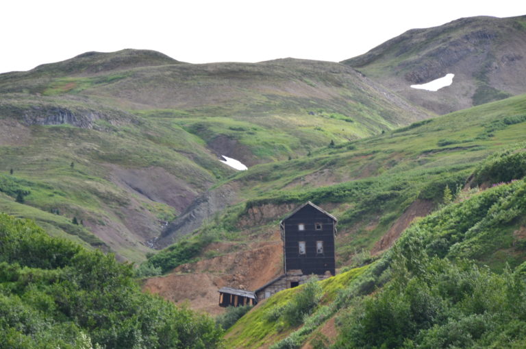
The Golden Zone mine, Golden Zone Property area and Chulitna Mining District have a long exploration and development history. Four periods are recognized: 1) 1907 – 1915 — Discovery and early prospecting; 2) 1929 – 1942 — Exploration and development related to W.E. Dunkle; 3) 1971 – 1983 — Start of modern exploration; and 4) 1985 – present — Exploration dominated by junior exploration companies.
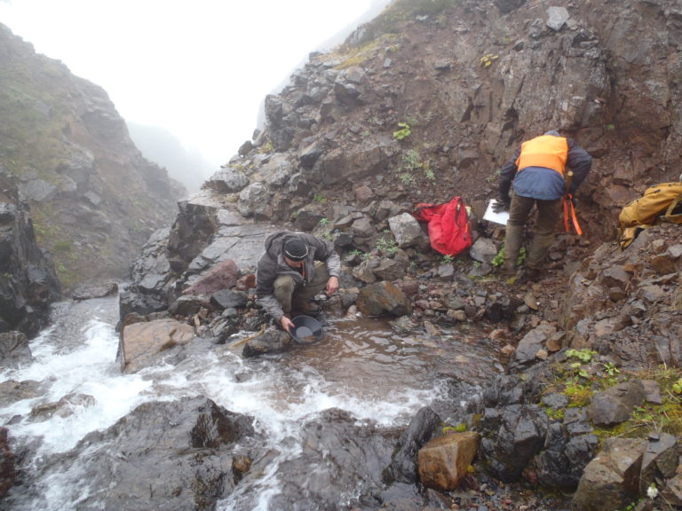
Approximately 30,000 m of drilling, both core and reverse circulation, has been conducted on the Golden Zone property, predominantly in the immediate area of the Golden Zone Breccia Pipe. Most of the drill core is preserved on site in two dedicated storage buildings. In addition to drilling, considerable geologic mapping, ground geophysics, geochemistry and a heli-borne EM and magnetic survey have been completed on the property, both at the Golden Zone Breccia Pipe and at several other prospects on the Property.
Geology
The Golden Zone gold-silver-copper property is a Intrusion-Related Gold System (IRGS) located in the Kuskokwim Mineral Belt on the south side of the Denali Fault in south-central Alaska.
Possible IRGS geological and exploration analogues for the Golden Zone Project include the Donlin Creek deposit, Alaska (+ 39 Moz), and the Dublin Gulch system (+ 6 Moz) in the Yukon.
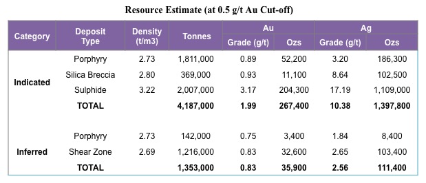
Technical Report
The property contains the Breccia Pipe Deposit that hosts a 2017 NI 43-101 Indicated resource of 267,400 ounces Au and 1,397,800 oz Ag (4,187,000 tonnes at 1.99 g/t Au & 10.38 g/t Ag).